Hey folks! Today we would like to share our hike to Gunung Nuang a couple of weeks ago. This was done as our preparation for Mt. Kinabalu. We picked Nuang as our training ground as most hikers within the Klang Valley are aware of the difficulty that Nuang poses — the distance, the wilderness, the steepness, although not so of the prominence as it is nothing compared to the mountains in the Crocker Range.
Before we start off with the lengthy paragraphs, we would like to accentuate some useful statistics on Gunung Nuang:
- Location: Pahang-Selangor border
- Available routes:
- via Kuala Pangsoon, Hulu Kelang
- via Janda Baik
- via Kampung Kemensah
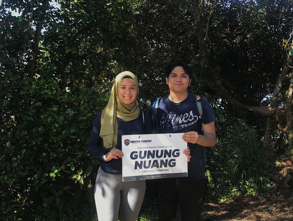
- Elevation: 1, 493 meters (4, 898 ft) — courtesy of Wikipedia
- Elevation gain: 1, 155 meters (3, 789 ft)
We managed the Janda Baik route as it is relatively easier as stated by bloggers. Even so, we had to start the morning earlier than usual as it is an hour journey from Kuala Lumpur.
Trail via Janda Baik:
- Transportation: 1-hr drive from KL, exit via Genting Sempah.
- Trailhead coordinates: 3.303979,101.887121 (You can easily copy paste this on GoogleMaps).
- Facilities: There is a RM10 parking fee per car just before the trailhead starts. The parking has a toilet provided.
- Distance from trailhead to peak: ~8 km
So, here comes the lengthy yet useful paragraphs if you are to summit Nuang via Janda Baik. First off, we would like to say that it is most recommended to start the hike early so you can finish by noon. Usually, it would start raining in the afternoon, so the earlier you get up, the better. We drove off from KL at around 5:30am and reach the trailhead at about 7am. Remember to eat your breakfast! This is a relatively long hike so be sure to fuel your body prior to the hike. Also, bring lots of water. We brought 6 liters of water, and it was just enough for the two of us until the end of the hike. Pack along some energy bars or light munchies in case you get hungry in the middle of the hike.
The thing with hiking early in the morning is that the cool weather in the jungle will make you more likely to forget to drink. However, you need to remind yourself to sip at least a little amount to avoid being dehydrated or getting headaches since you are constantly moving. Thus, drinking plenty of water is a must!
Okay, enough with the safety precautions. Let’s roll in the best part of the hike.
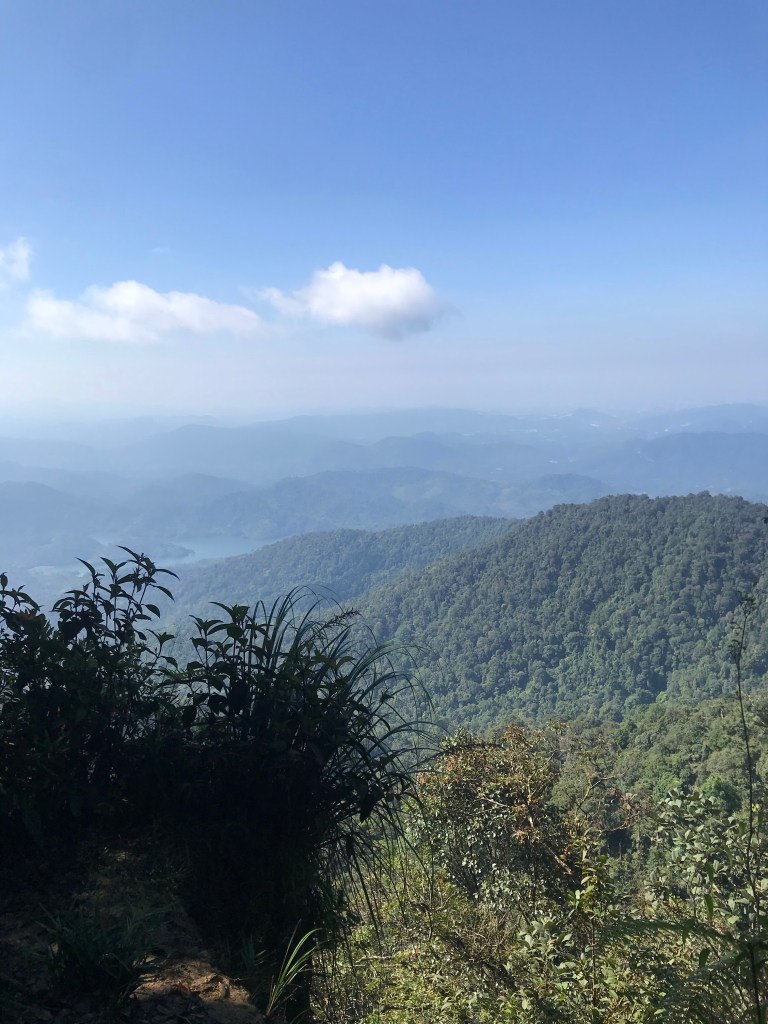
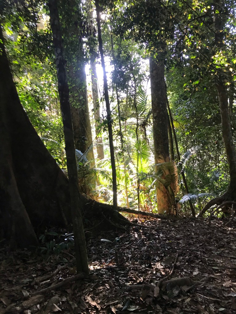
We started off at 7:27 am, walking from the car park to the starting point. Here, you must cross a short stream to get to the other side. Then, we passed through some agriculture farms that stretched out probably for 15 minutes. *Please note that the hike hasn’t started yet at this point. This is merely a brisk walk. Then, walked through a sandy route fit for a 4WD and this went on for another 15 minutes before coming to a 3-way route. We proceeded on by taking the middle route, which led up to a hill, and here is where the aching starts. We also found out from fellow hikers that this trail normally used by ultra-runners as part of their training. Anyway, this trail leads to the deep rainforest where you’ll find yourself overwhelmed by the millions of various trees and plants that make up the profile of the mountain. This went on for awhile until you reached Chemperoh waterfall. *Also! Tip on not getting yourself lost: Follow the colored signs on trees or tapes belted around the trees.

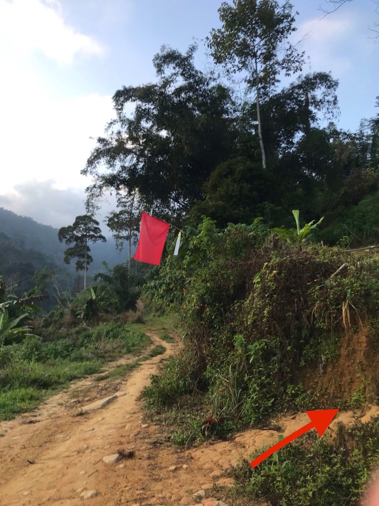
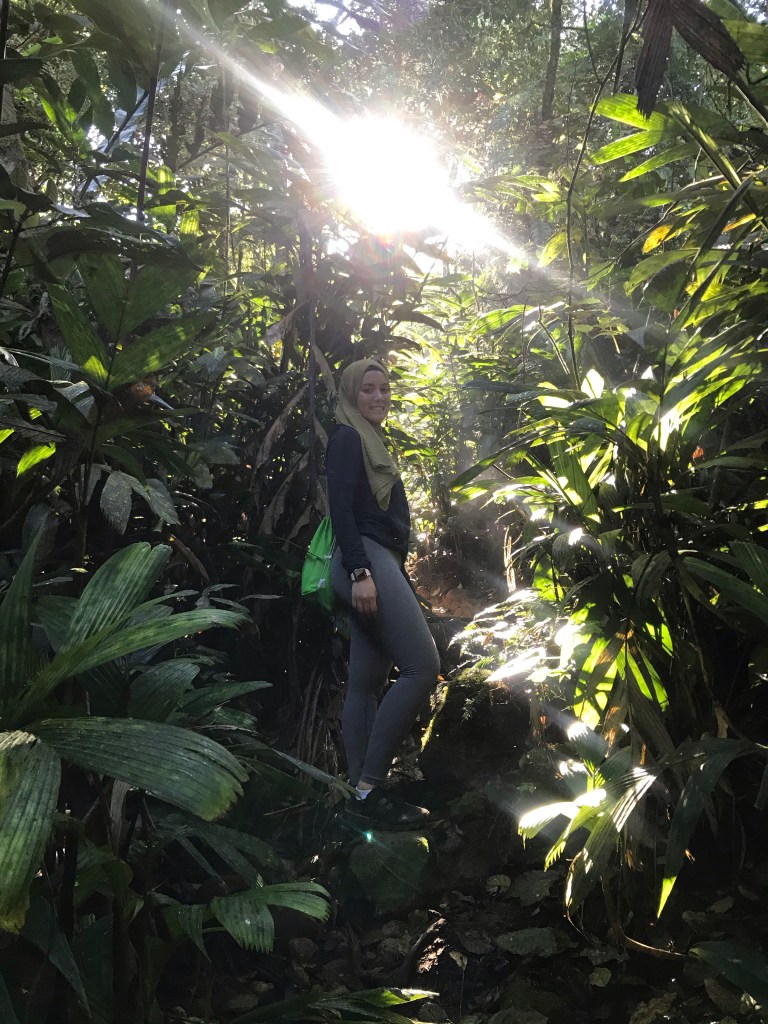
Once we have reached the Chemperoh waterfall, we crossed a second stream to get to the other side. Then, we took a left and continued our hike. Some might get confused here and take a right, but it’s a dead end anyway, so you’re bound to take the left from where you crossed the stream, and soon you’ll find the tapes on trees like what we mentioned earlier. The trail gets steeper at this point so if you have a hiking pole, this would be handy. But, if you don’t, work those asses off! You’re getting yourself a booty… and leg day. The trail from here is pretty straightforward, there is only one path at this point on, so it’s impossible to get yourself lost. Again, mind the tapes belted around the trees! Be wary of your surrounding. The steep route after Chemperoh waterfall gets most of the elevation gain, as it is steppy steep steps all the way up. You may start getting tired or headaches, but remember to drink water once you feel tired. Water is your best friend at this point. Many hikers had their chances of meeting pacat (english: leeches) during this hike, so please wear appropriately.
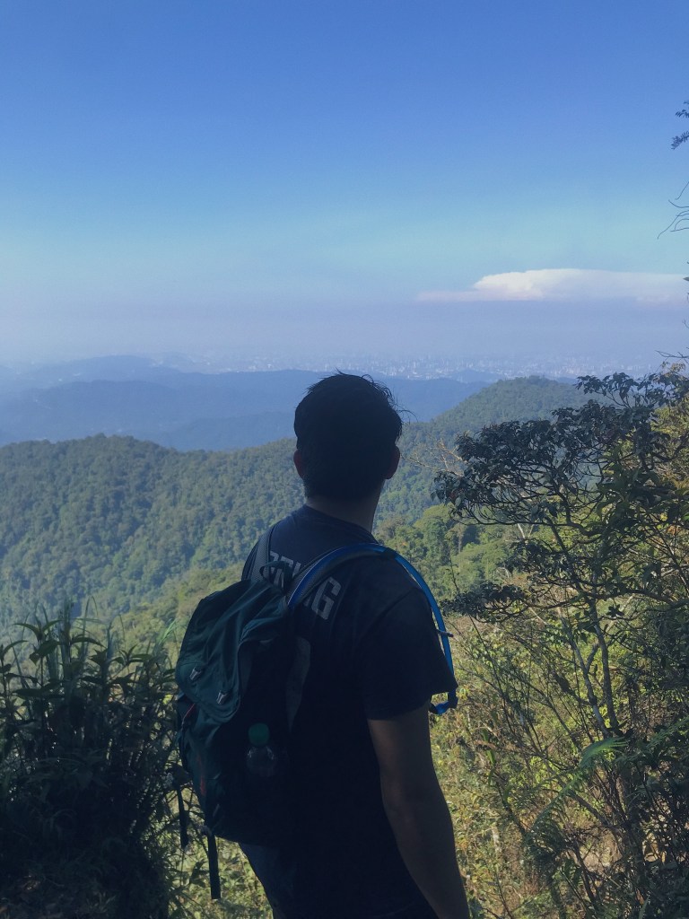
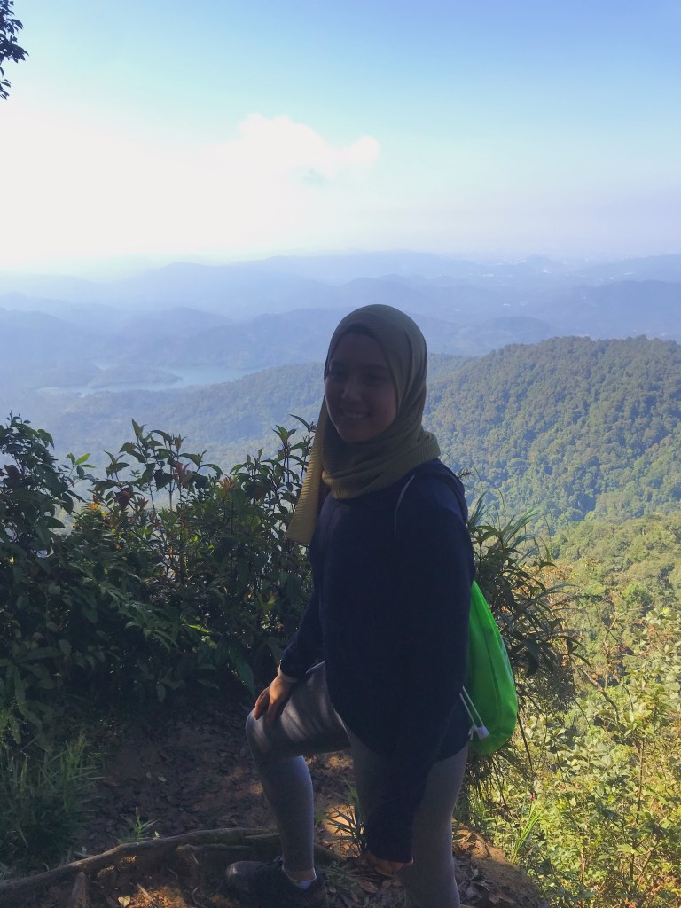
About an hour or so of hiking, you will encounter the mossy forest. When you get here, you will realize that the elevation gain is legit and that you’re almost there. There are ropes at this point of the trail to assist you in those sloping, difficult reaches. 10 minutes or so, you will finally reach the peak! Like us! Congratulations, you’ve made it to the top!
Now, it’s just a matter of going back down. The same way. Only, this time, your ankles will ache.
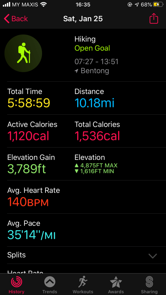
As for us, we made to the peak in 2:59 hrs, and back down in 5:58hrs. We reached car park at 1:51 pm, covering a total distance of 16-ish km. Our tip is slow and steady wins the race, and we avoid stopping for more than 15 seconds, until we reached the peak or carpark. We believe that when you have the momentum to push yourself further, go for it and don’t stop. Otherwise, you’ll tire yourself. You may have a different approach that speaks to you, and that’s completely fine. It isn’t a race. The idea is to get up and down the mountain all in one piece. So, safety is key.
Tip: If you’re a beginner, we don’t really recommend Nuang as your first hike. You should try Broga or other hills equivalent to that prior to this hike.
Also, if you’re unfamiliar with the trails, hike within a group, and most probably during the weekends as more people tend to hike during this time. You will feel safer this way, and you get to meet new friends too.
If you think you’re slow or heavy, don’t get the mountains discourage you. Just start earlier, and at a steady pace, whatever pace that may be. The key is to get up and down in a safely manner.
More hiking posts coming up!
Til then,
Fahim & Yasmine
P.S.: Please carry your trash with you. Treat the rainforest as an exotic destination, and not your home! Your trash doesn’t belong in the forest, it will not decompose so don’t litter!
